
Hi & Welcome To My Map & Print Store!
Here you can find pinned hiking routes and photography prints from the UK and beyond.
Maps
All hiking routes are laid out using pins on the Maps.me app. This free, offline map can be used on Android or IOS mobile phones, Ipads and tablets and are a useful aid for navigating in the mountains.

Llyn y Fan Fach/Fawr Hiking Route Pins – £3.99
Five classic routes for hiking Llyn y Fan Fach/Fawr as described in my hiking Llyn y Fan Fach guide. Routes are pinned using the Maps.me offline maps app. Simply download the app (if you don’t have already it) and I’ll send you the pins.
The Maps.me app is completely free to download and use. Country/area maps are downloaded ahead of time so they can be used offline and without phone signal. Toggle the “terrain” feature on, to see contour lines which help identify peaks and valleys.
Use the pinned routes as a helpful GPS tool for your next hike, alongside your regular method of navigation.
Please be aware that due to technical issues, downloads may take up to 24 hours to be delivered. Please email me first if you require an instant download.
Brecon Beacons Route Hiking Pins – £9.99
Enjoy 35 beautiful hikes in the Brecon Beacons with the help of these pinned routes. The routes include 12 hikes described in my hiking Brecon Beacons hiking guide and 3 waterfall walks described in my Brecon Beacons waterfall guide. Hiking routes include the ever popular Pen y Fan, Llyn y Fan Fach, Sugar Loaf and the Four Falls.
Routes are pinned using the Maps.me offline maps app. Maps.me is completely free to download and use. Country/area maps are downloaded ahead of time so they can be used offline and without phone signal. Toggle the “terrain” feature on, to see contour lines which help identify peaks and valleys.
Simply download the app to your mobile phone or tablet (if you don’t have it already) and I’ll send you the pins. Open the pins in Maps.me to see the colour-coded routes. The starting pin for each route displays the distance, elevation gain and difficulty level for that hike. Since the routes are saved into individual folders, toggle between having all of the pins on display or just select the route you have chosen for that day.
Use the pinned routes as a helpful GPS tool for your next hike, alongside your regular method of navigation.
Included routes:
- Pen y Fan x 5
- Llyn y Fan Fach/Fawr x 5
- The Elidir Trail x 2
- The Four Falls Trail x 3
- Fan Nedd & Fan Gyhirych
- Craig Cerrig Gleisiad
- Fan y Big Loop
- The Canadian War memorial Loop
- Waun Rydd horseshoe
- Blaen y Glyn waterfalls
- Mynydd Llangorse & Mynydd Troedd
- Waun Fach & the Dragons Back
- Table Mountain Loop
- Sugar Loaf x 2
- The Blorenge x 3
- Skirrid Mountain x 2
- Llanthony Priory Loop
- Eywas Valley Loop
- Hay Bluff, Twmpa & Black Mountain Loop
- Fan Foel & the Brecon Canal
Please be aware that due to technical issues, downloads may take up to 24 hours to be delivered. Please email me first if you require an instant download.
Snowdon Route Maps – £2.99
Six classic routes for hiking Snowdon as described in my hiking Snowdon guide. Routes pinned using the Maps.me offline maps app. Simply download the app (if you don’t have already it) and I’ll send you the pins.
Routes are pinned using the Maps.me offline maps app. Maps.me is completely free to download and use. Country/area maps are downloaded ahead of time so they can be used offline and without phone signal. Toggle the “terrain” feature on, to see contour lines which help identify peaks and valleys.
Use the pinned route as a helpful GPS tool for your next hike, alongside your normal method of navigation.
Please be aware that due to technical issues, downloads may take up to 24 hours to be delivered. Please email me first if you require an instant download.
Pen y Fan Routes Map – £2.99
Five classic routes for hiking Pen y Fan as described in my hiking Pen y Fan guide. Routes are pinned using the Maps.me offline maps app. Simply download the app (if you don’t have already it) and I’ll send you the pins.
The Maps.me app is completely free to download and use. Country/area maps are downloaded ahead of time so they can be used offline and without phone signal. Toggle the “terrain” feature on, to see contour lines which help identify peaks and valleys.
Use the pinned routes as a helpful GPS tool for your next hike, alongside your regular method of navigation.
Please be aware that due to technical issues, downloads may take up to 24 hours to be delivered. Please email me first if you require an instant download.
Disclaimer: Please note these route pins are correct and accurate to the best of my knowledge and experience at the time of writing. Routes can often be diverted and all relevant countryside signs should be followed. Mountain walking can be a dangerous activity and these routes are not a replacement for use of a map and compass. Wandering Welsh Girl accepts no responsibility for any injuries incurred whilst using this product. Follow these routes at your own risk.
Photos
All photographs are printed on Hahnemuhle Photo Luster paper at a 260gsm thickness. Photo Luster is a microporous, resin coated photo paper with a beautiful luster surface.
Its weight provides a higher stability than many other photo papers and guarantees long lasting, fade resistant prints.
All images will be printed without watermarks. If you see any images on this site that currently aren’t available for printing please get in touch.
Prints come in 3 standard sizes, perfect for wall hangings around your home.
| A4 |
210 x 297mm, 8.3 x 11.7inch |
| A3 |
297 x 420mm, 11.7 x 16.5inch |
| A2 |
420 x 594mm, 16.5 x 23.4inch |
If you see any photos on this website or on my social media channels that you would like to purchase then please contact me here.
Photography Partnerships
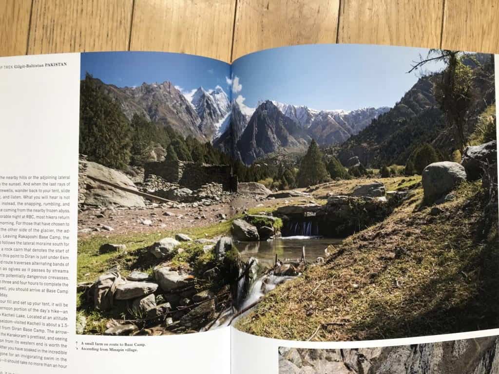
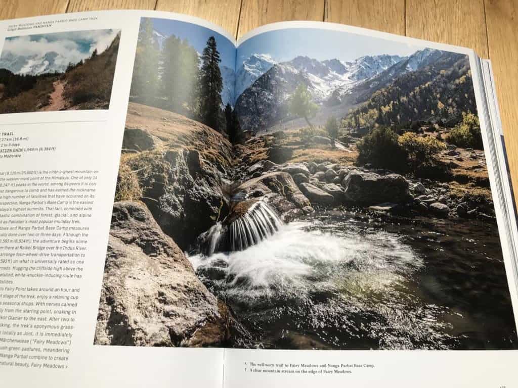
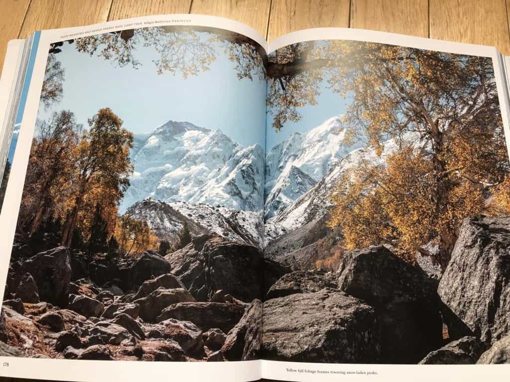
In 2022 I teamed up with renowned publishers Gestalten for their latest book, Wanderlust Himalaya. This impressive book is a collection of detailed hiking guides for the Himalaya region and features many of my photographs for the Pakistan hikes. Take a look at the book here.
If you’d like to purchase any of these prints please send me an email.

In 2023 I teamed up with Gestalten again for the latest in their Wanderlust series – Hikes in the British and Irish Isles. This beautiful book provides information on long distance hikes and my photos feature on treks in England, Wales and Ireland. You can view Wanderlust British and Irish Isles here.