
Last Updated on 11/06/2025 by Louise
Snowdonia National Park (Parc Cenedlaethol Eryri) in North Wales covers an area of 2140km², making it the largest National Park in Wales. Scattered over this vast area are nine mountain ranges with dramatic craggy peaks, over 100 picturesque lakes, 23 miles of scenic coastline and a multitude of peaceful woodland areas.
To fully appreciate all this natural beauty there is an abundance of Snowdonia walking routes for hikers of all abilities to enjoy.
Top Snowdonia walks can vary from strolling along coastal beaches to scrambling along the top of high mountain peaks. Some of the paths are well trodden and maintained, whilst others require some navigational mountain experience.
In this guide I describe 11 of the best Snowdonia walking trails. 8 of these beautiful Snowdonia mountain walks involve varying levels of scrambling with exposed edges, which offer an added challenge to your mountain adventure.
The Top 11 Snowdonia Hiking Routes At A Glance
|
Watch Hikes In Snowdonia (Eryri)
Here is a video of some of our hikes around Snowdonia, including Glyder Fawr, Glyder Fach, Y Garn, Yr Wyddfa and Y Lliwedd.
The Best Walks In Snowdonia – What Can You Expect On Each?
Below I provide an overview of each hike. In the trail description I provide distances, times, difficulty level and starting locations linked to Google maps so you can decide which Snowdonia hike you’d like to try.
In 2022 a vote by the Snowdonia National Park Committee determined that Snowdon and Snowdonia should be called by their Welsh names in both Welsh and English context. This means that Snowdon will be known as Yr Wyddfa and Snowdonia as Eryri. Whilst this transition is being made, in this guide I will use both interchangeably.
For all the top things to do in Eryri, take a look at this guide.
1. The Snowdon/Yr Wyddfa Horseshoe
- Distance: 12km
- Elevation gain: 1062m
- Time: 8 hours
- Starting Point: Pen y Pass (Take the Sherpa Bus from Llanberis)
- Difficulty: Strenuous
- Highlights: Crib Goch traverse
- Map: Explorer OL17
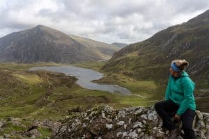
The Snowdon Horseshoe refers to the horseshoe shaped ring of peaks that make up part of the Snowdon Massif. This fabulous ridge walk provides incredible views throughout, making it one of the best hikes in Wales.
This challenging mountain day takes in several Snowdonia ridges and summits and should only be attempted if you’re comfortable in the mountains and with scrambling along exposed edges.
Do not try this walk if you have a fear of heights!
This Yr Wyddfa circuit starts from Pen y Pass, following the well signposted PYG Track towards the highest peak in Wales. If you’re interested in discovering alternative routes to the summit of Snowdon, take a look at this post.
Upon reaching Bwlch y Moch the real fun begins! Take the right hand path which leads to the first scramble of the day, up onto Crib Goch. Once at the top you will begin the traverse of Crib Goch Ridge, which is 500m of exposed, rocky ridge scrambling.
With the excitement (terror?!) of Crib Goch over, it’s another scramble onto the second highest point in Wales, Crib y Ddysgl (Garnedd Ugain). From here it’s a straightforward walk onto to Yr Wyddfa summit to join the crowds, before descending via the Watkin Path to Bwlch y Saethau.
The final summit of the day, Y Lliwedd, involves some more, albeit easier, scrambling before beginning the gradual descent towards Llyn Llydaw. Join up with the well trodden Miners Track to complete the loop back to Pen y Pass.
On your trip to North Wales don’t forget to visit one of the many castles on offer. Discover the prettiest castles to visit in this guide!
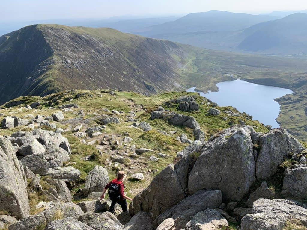
2. The Glyderau via Devils kitchen
- Distance: 12.5km
- Elevation gain: 855m
- Time: 5 – 7 hours
- Starting Point: A5 parking near Glan Denau
- Difficulty: Moderate
- Highlights: The other worldly rock formations on Glyder Fach and views of the Ogwen valley
- Map: Explorer OL17
For more detailed walking routes on the Glyderau, take a look at this guide!
The Glyderau (not the Glyders!) are a group of mountains that get their name from the two highest peaks in the group – Glyder Fawr and Glyder Fach. Hiking onto the Glyderau via the Devil’s Kitchen is one of the classic hikes in Eryri.
This hike starts from Glan Denau and is a trudge along the A5 to Ogwen Visitor Centre. Here begins a well made path up to Cwm Idwal. Reaching Llyn Idwal provides the first scenic view of the day.
Enjoy the gentle walk around the lake before ascending into Devil’s Kitchen or Twll Du in Welsh. This rocky trail climbs steeply between two crags to reach the plateau. Walk around Llyn y Cwn before taking on the next challenge, which is a loose scree ascent to Glyder Fawr.
Once at the summit it’s a fairly straight froward walk first down, then up onto Glyder Fach, passing the intriguing rock spires of Castell y Gwynt along the way. However, if the weather is poor some compass navigation maybe required.
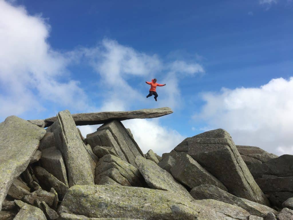
Just beyond Glyder Fach summit is the Cantilever stone which makes for an iconic Snowdonia photo. From Glyder Fach you can descend to Bwlch Tryfan via Bristly Ridge if you’re feeling brave, however I suggest taking the easier path to the east.
Once at the Bwlch there is the option to make a side trip up the South Ridge of Tryfan. This bouldery climb is the easiest route to the top of this fabulous peak and is worth the effort if time and fitness levels allow.
From Bwlch Tryfan there is a straightforward, though initially fairly steep path, down through Cwm Tryfan to the starting point at Glan Denau.
If you are looking for the best scramble in Snowdonia then an alternative to this route is the Bochlwyd Horseshoe. This route ascends via the challenging North face of Tryfan and Bristly Ridge of Glyder Fach and descends via Y Gribin. All of which are grade 1 scrambles.


Read Next
Most popular tours in Eryri (Snowdonia)
- ⛰️ Snowdonia National Park has so much to explore, but this Snowdonia National Park Underground Adventure takes you underground to an old, abandoned slate mine for a unique experience
- 🌄 Climb the mountains of Snowdonia with an experienced and qualified guide and experience some of the best mountain scenery in the UK
- 🛶 On this tour you’ll enjoy stunning views of Snowdon and its dramatic mountain range from the comfort of your Kayak
3. Cader/Cadair Idris Minffordd Path Loop
- Distance: 9.2km
- Elevation gain: 862m
- Time: 5-6 hours
- Starting Point: Minffordd Car Park
- Difficulty: Moderate
- Highlights: The ridge walk to Craig Cwm Amarch
- Map: Explorer OL23
Cader Idris or Cadair Idris is found in Southern Snowdonia away from main hub surrounding Mount Snowdon. This loop provides a beautiful scenic walk and is a must-do for anyone exploring Snowdonia National Park.
There are various routes to the summit of Cader Idris, but the Minffordd Path offers a great ridge walk with views of Cwm Cau along the way.
This loop starts from the car park at Minffordd and follows a well trodden path through a pretty wooded gorge. Be warned there are lots of steps on this trail but it at least gets lots of the climbing over and done with.
Keeping left at both forks the effort is soon rewarded with views of Llyn Cau and Cader peak. After admiring the views the ridge climb begins to the first summit of Craig Cwm Amarch. From this peak there is a short descent to the bwlch, before making the final climb to Cadair summit.
Cadair Idris is a popular hike so don’t expect to have the summit to yourself. Once you’ve taken in the views it’s time to continue the loop along the ridge towards Mynydd Gwerngraig.
This path stays high, providing views over Cwm Cau until it breaks away from the ridge and descents quite steeply back into the valley. Cross the bridge and rejoin the Minffordd Path to retrace your steps through the gorge and back to the car park.
There’s a tearoom near the car park if you want to reward yourself with a delicious cream tea!


4. Cnicht, Moelwyn Mawr & Moelwyn Bach Loop
- Distance: 15.4km
- Elevation gain: 947m
- Time: 6 – 8 hours
- Starting Point: Croesor village
- Difficulty: Moderate – strenuous
- Highlights: Scrambling up Cnicht AKA the Welsh Matterhorn
- Map: Explorer OL17
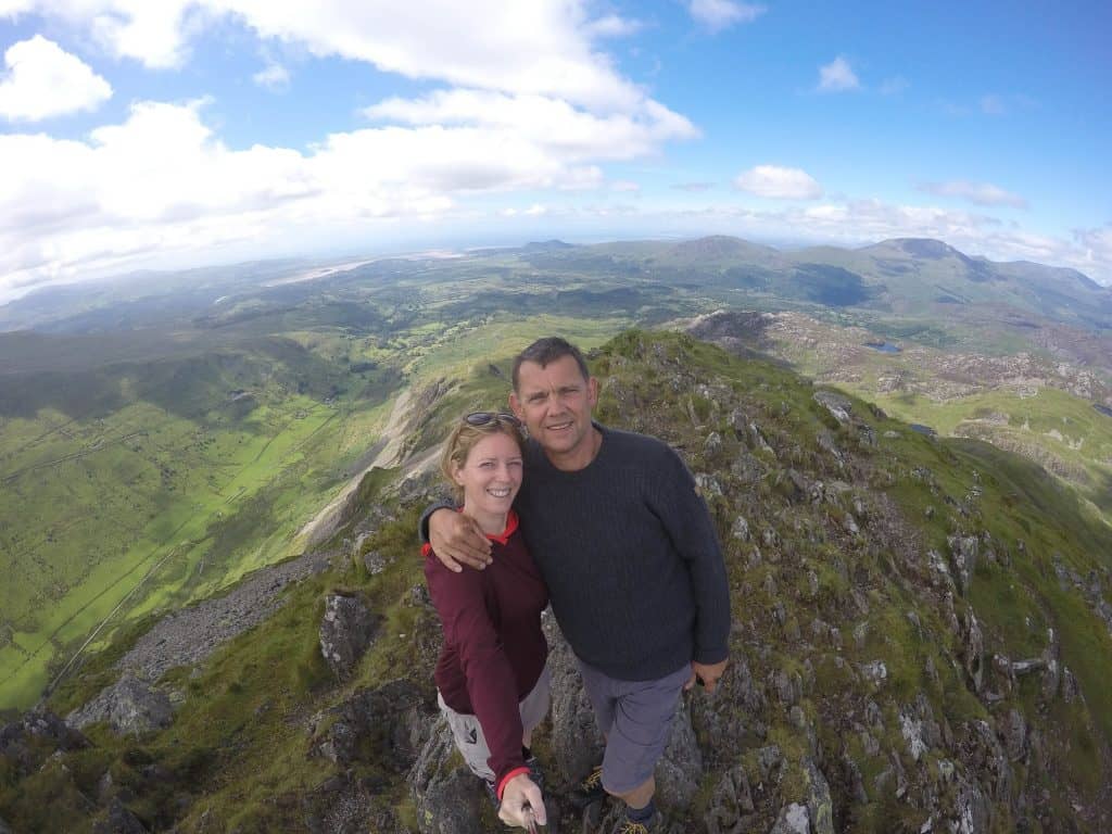
Cnicht is a perfectly shaped, pyramid mountain which is affectionately know as the Welsh Matterhorn. This full mountain day loop walk also takes in the peaks of Moelwyn Mawr and Moelwyn Bach, collectively known as the Moelwynions.
Struggling to pronounce all of these Welsh mountain names? Learn how to say Welsh words in this handy guide!
The starting location for this hike is in the secluded village of Croesor, with free parking at the Snowdonia National Park car park. On clear days you can enjoy views of Cnicht and the Moelwynions for most of the walk to Cnicht peak. The trail to Cnicht is well signposted.
To attain the summit there is a short but fun scramble, although the worst of this can be avoided by following the path to the right. The reward from the top of this climb are breathtaking 360 degree views, with a real feeling of remoteness. However there’s much more to see!
Continue down from the summit towards the pretty Llyn yr Adar, before turning left towards Rhosydd Slate Quarry. The trail becomes more faint here and is very boggy in parts. Navigation can be tricky especially in poor weather.
After passing through the quarry the next climb begins for the craggy summit of Moelwyn Mawr. Take a moment to again enjoy panoramic views of Snowdonia National Park at the summit. Descend Moelwyn Mawr to the southeast before making the final ascent to Moelwyn Bach, which is thankfully 60m lower than it’s bigger brother.
From Moelwyn Bach there’s a long gradual descent along the ridge, passing through a forrest before joining a small road that leads back to Croesor village.


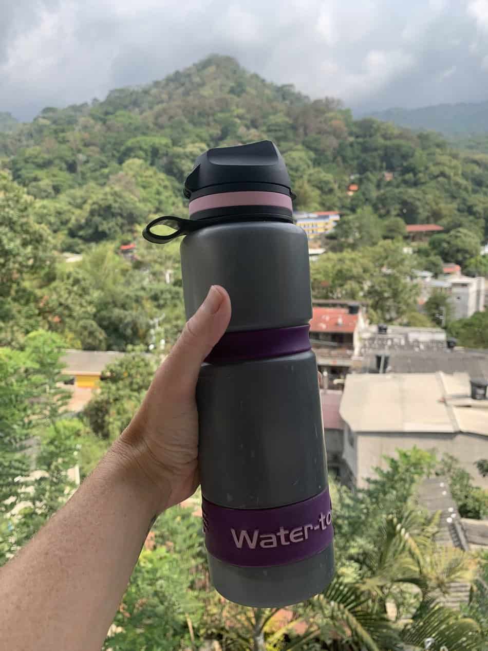
Get 15% off WTG!
Filtering water bottles are perfect for hiking since you can use them for safely refilling in streams and rivers. I’ve secured a deal for all readers of this website with a company that make the perfect filtering water bottles, Water-to-go. Simply use code WWG15 at checkout to get a 15% discount off all Water-to-go bottles and filters.
5. Moel Siabod from Pont Cyfyng
- Distance: 11.6km
- Elevation gain: 817m
- Time: 5 hours
- Starting Point: Bryn Glo Lay-by, Pont Cyfyng
- Difficulty: Moderate
- Highlights: Scrambling up Ddaer Ddu to the summit
- Map: Explorer OL17
Perhaps I’d better start with how to pronounce this one since I’ve heard it said incorrectly so many times! Rather than thinking Mo-el Sia-bod, try Moyle Sha-bod and you’ll blend in with the locals quite well.
Although this loop is the easiest mountain adventure on this list it’s still a great walk in Snowdonia. Starting from Bryn Glo car park there’s not much time for a warm up, as the track heads steeply uphill until it reaches the open hillside.
Pass by a disused quarry and two smaller lakes as you gradually climb towards Llyn y Foel. Beware the boggy ground along the way. It’s here the fun really starts with the 1km long, straight forward scramble up Ddaer Ddu towards the summit.
At the bouldery summit you can enjoy great views of Snowdon to the east. The path for the descent is not as obvious and can prove a navigational challenge in low visibility. The walk back down along the ridge is long and bouldery making it tricky underfoot.
Once off the rocky shoulder, continue down the steep grassy descent before rejoining the path which leads back to the starting point at Pont Cyfyng. For a detailed hiking guide of Moel Siabod take a look at this post.


6. Tryfan’s Heather Terrace
- Distance: 7km
- Elevation gain: 700m
- Time: 5 hours
- Starting Point: Lay-by next to Gwern Gof Campsite on the A5
- Difficulty: Moderate
- Highlights: Scrambling up Tryfan’s South Ridge and the beautiful heather in late Summer
- Map: Explorer OL17
Tryfan is probably my favourite Welsh mountain. When you view it from Ogwen Valley it just looks like there would be no way to hike to the top. But there are in fact a few options to tame this beast!
The most straightforward way to hike Tryfan is via the Heather Terrace Path. Let me be clear and say that there is no easy route up Tryfan and this walk does involve scrambling and route navigating skills, more so in poor weather. If you want to tackle Tryfan’s north ridge, which is probably the best route to the summit of Tryfan, I recommend hiring a guide or hiking with someone who is confident with the route.
From Gwern Gof Campsite you are immediately spat out onto the base of the mountain. Follow the trail to the right of Tryfan Bach as if heading to the North Ridge, before forking to the left to take up Heather Terrace trail. Be sure to keep clear of the North Ridge unless you are very confident in the mountains.
This path ascends along Tryfan’s east face and is fairly straightforward. The scrambling begins upon reaching Tryfan Far South Peak, turning north to make your final push for the summit.
On the summit you will see hikers test their bravery by jumping between the two exposed pillar rocks of Adam and Eve.
To descend, retrace your steps off the south side of the mountain and carefully traverse around Tryfan Far South Peak to Bwlch Tryfan. There is an obviously steep path down into Cwm Tryfan which then leads back to the campsite where you began.


7. Pen yr Ole Wen and The High Carneddau
- Distance: 15km
- Elevation gain: 980m
- Time: 7 hours
- Starting Point: Glan Denau on the A5
- Difficulty: Strenuous
- Highlights: Strolling along the ridge between Daffydd and Llywelyn
- Map: Explorer OL17
The Carneddau are big mountains with many of the highest peaks in Eryri (Snowdonia). If you’re looking for a big mountain day with a large amount of up, then this hike is for you!
This route climbs Pen yr Ole Wen from the east which includes a short but straightforward scramble. Then there is a short climb to Carnedd Dafydd followed by a ridge walk and another short climb to Carnedd Llywelyn.
From the highest peak there is some steep loose scree on the descent followed by another, quite technical rock slab scramble, before a long walk back to the start.
For a detailed trail description of this Pen Yr Ole Wen route, click here.
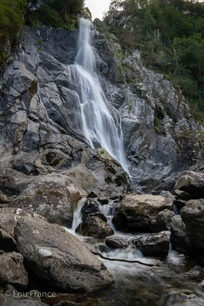
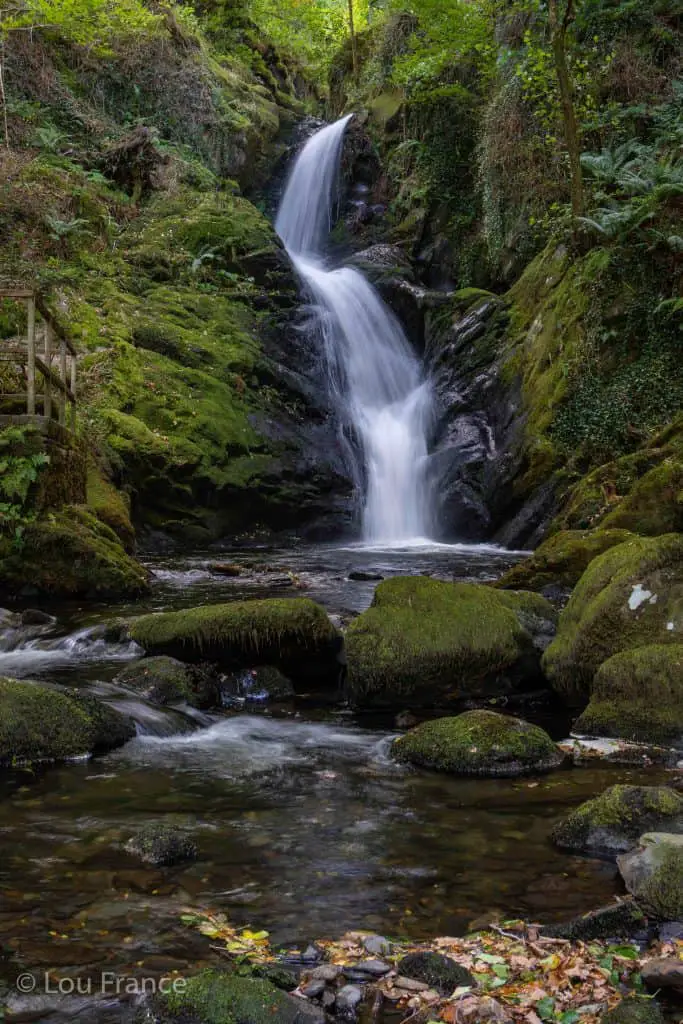
8. Aber Falls
- Distance: 4km
- Elevation gain: 150m
- Time: 2 hours
- Starting Point: Car parks beyond Abergwyngregyn
- Difficulty: Easy
- Highlights: The mighty impressive Aber Falls
- Map: Explorer OL17
This easy, out and back walk can be enjoyed by the whole family and provides a fabulous view of Aber Falls, which with its huge 40m drop is the most impressive waterfall in Snowdonia.
The most challenging part of this walk comes via the single track road used to access the car park at Bont Newydd! At peak times this road can require some negotiating as cars juggle for passing places.
There are two car parks (pay and display) which have signposts to mark the start of the trail. Once on the gravel path the walking is straight forward. It’s a gradual ‘up’ with some steeper sections.
Your efforts however are more than rewarded with two viewpoints of this beautiful waterfall.
This waterfall made it on to my list of the most beautiful waterfalls in Wales. Discover all the other waterfalls to make the list here!
9. Aberglaslyn, Llyn Dinas & Cwm Bychan
- Distance: 10km
- Elevation gain: 250m
- Time: 4 hours
- Starting Point: Lay-by on the A498 near Llyn Dinas
- Difficulty: Easy/Moderate
- Highlights: Views of Snowdon, Cwm Bychan and cascades on Afon Glaslyn
- Map: Explorer OL17
This relatively low-level walk has a little bit of everything! It offers great mountain views, tumbling river cascades, pretty villages and some interesting Welsh history.
From the lay-by make your way to the edge of Llyn Dinas and follow it around to the right. Take the stone footpath up the hill, towards the pass. At the top of the climb you are rewarded with views of the Snowdon massif to the north and Moel Siabod to the northeast.
Continue through the pass and down into Cwm Bychan. Here you will see the remains of a ropeway which is a relic from the copper mining industry. As the valley flattens out you can see Cnicht and the Moelwynion mountains to the east.
At the bottom of the valley there is a car park with a toilet if needed. The trail then heads back uphill before meeting the Glaslyn river. This is now the beautiful Aberglaslyn gorge.
Follow the river until you reach the train tracks. Cross over the tracks and walk towards the pretty village of Beddgelert.
Take the side trail to visit Gelert’s grave and learn about a great Welsh legend!
From Beddgelert the path joins a country lane as it continues onto Sygun Copper mine, which you can also visit if you have the energy. Rejoin the path as it once again follows the river back towards Llyn Dinas and the end of this scenic low level Snowdonia walk.

Once you’ve fully explored Snowdonia why not head to South Wales and hike the best of the Brecon Beacons?
10. Dolgoch Waterfall Walk
- Distance: 2.5km
- Elevation gain: 110m
- Time: 1-2 hours
- Starting Point: Dolgoch Falls Car Park
- Difficulty: Easy
- Highlights: So many pretty cascades and two big waterfalls
- Map: Explorer OL23
This wooded gorge walk is a must for any visit to Southern Snowdonia. The trail is well signposted and easy to follow.
Follow the path alongside the river to a viewing point of the lower falls. Take the right fork to climb the steps to a viewing point of the upper falls, before continuing to a picnic site at the end of the trail.
Avoid the steep steps on your return by taking the right fork through the woods, which rejoins the outbound path further downstream.
The car park is pay and display and has a small cafe to enjoy refreshments after your walk.
11. Nantlle Ridge Walk
- Distance: 14.5km
- Elevation gain: 1077.5mm
- Time: 5-8 hours
- Starting Point: Rydd Ddu car park
- Difficulty: Moderate
- Highlights: Summit 7 peaks along a spectacular ridge walk
- Map: Explorer OL17
The Nantlle Ridge is a range of mountains on the west side of Eryri (Snowdonia) National Park. This stretch of mountains includes severn peaks ranging between 600 meters and 800 meters in height.
The Nantlle Ridge traverse is 14.5km in length and gains over 1000m in height. Although this ridge is nowhere near as technical as the Snowdon Horseshoe nor as long as a traverse of the Carneddau, it offers incredible views throughout and is edgy enough to provide that true ridge feeling.
A traverse of this ridge can be walked in either direction but involves two cars or the use of public transportation. The start and end points are Rhydd Ddu car park and the village of Nebo.
For more information on hiking the Nantlle Ridge see this guide.

Be Prepared For Your Snowdonia Adventure!
Before you attempt any of these Eryri (Snowdonia) hiking trails make sure you are properly prepared with both equipment and knowledge.
Check the weather forecast beforehand and then decide if the route is right for you on that day. Several of these routes have exposed edges and steep drops, which can be treacherous in wet, windy and foggy conditions.
The first severn Eryri (Snowdonia) treks all require a good level of map reading skills and in poor visibility may rely on compass use. If you’re looking for a mountain leader to guide you along your way then please get in touch with me here. As a certified mountain leader raised near the mountains of Bannau Brycheiniog, I’d be happy to teach you all about the mountains of my home country.
Once you have chosen your route, make sure you have all the equipment you need. Here is a list of basic equipment needed to enjoy these fabulous Snowdonia hikes.
- Suitable clothing: warm layers and waterproofs
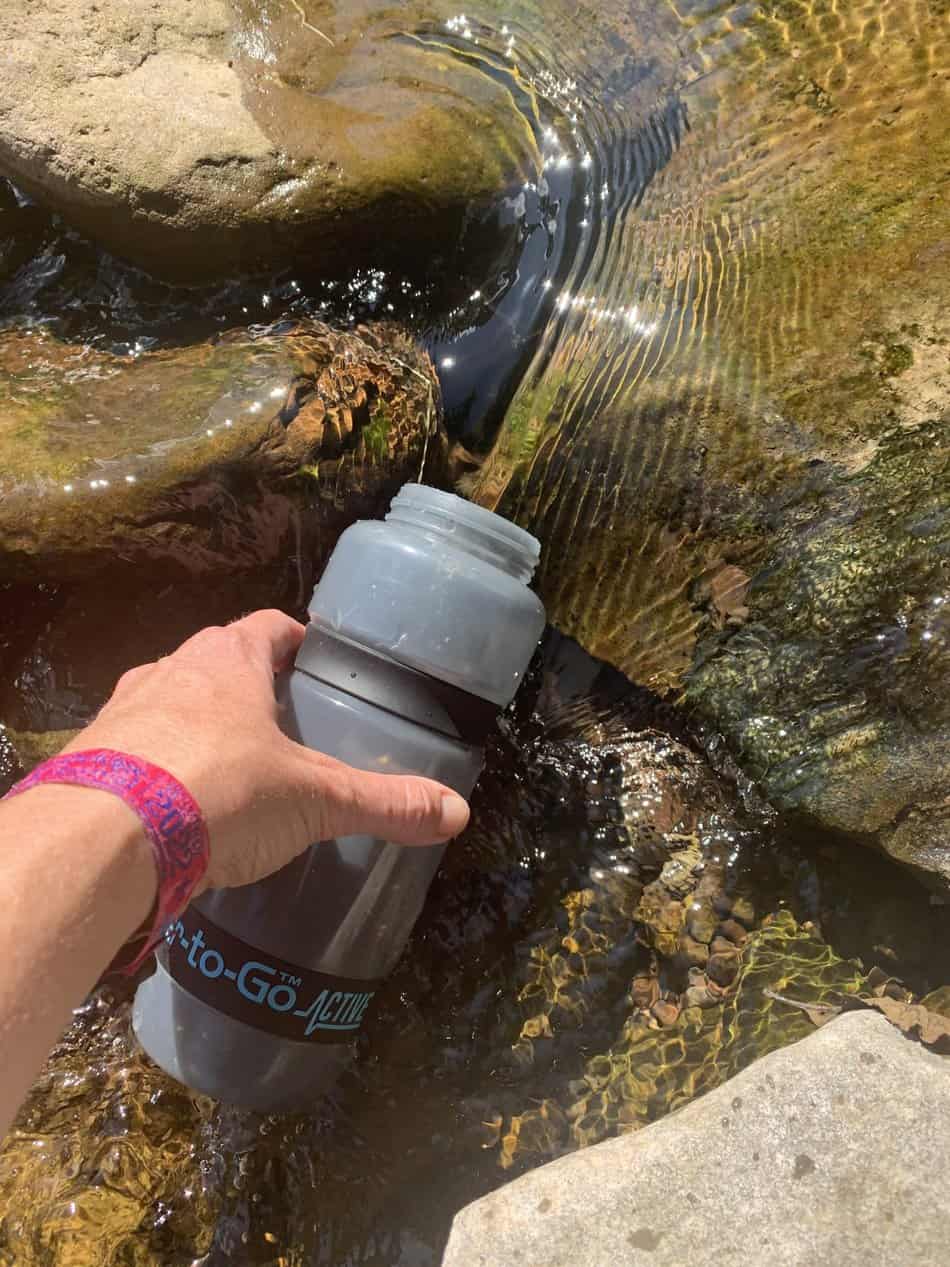
- Water, food, snacks: filtering water bottles are very handy for safely refilling in streams and rivers. You can read more about filtering water bottles in this guide. Psst! I’ve secured a deal for all readers of this website. Simply use the code WWG15 at checkout to get a 15% discount off all Water-to-go bottles and filters.
- Quality hiking boots or trail shoes are a must
- The relevant map and compass, and the ability to use them!
- A first aid kit for hiking
- GPS or mapping app:A great free app option is maps.me, although the free features have now become limited. I have an annual subscription to OS which means I have access to all UK OS maps on my mobile. I can definitely recommend it if you’re a regular hiker/walker.
These are just some of the essentials, but for a complete list of things to take on a hike in Wales, take a look at this guide!
TRAVEL TIPS
🏘️Book your accommodation
Booking.com and Agoda will help you to book accommodation in advance and check availability.
✈️Book your flight in advance
To find the cheapest flight options, you can use WayAway and find the most suitable option for you.
🧾Get your tickets and guided tours
Book your tours with Viator to get the most out of your journey.
The Best Eryri (Snowdonia) Walks Summary
As the largest National Park in Wales, Eryri has many options to offer hikers of all abilities. In this guide I have suggested 10 top Snowdonia trails, most of which require some mountain experience. These paths are located in different regions of the park and will take several visits to complete.
If you are unfamiliar with map reading or are new to scrambling, consider using a guide before attempting these hikes.
If you are planning to explore hikes in Central or Northern Snowdonia, Llanberis or Betws y Coed are great towns to base yourself in.
Like it? Pin it for Later!

Join my Newsletter Today!
Recent Posts
11 Best Waterfalls in South Wales (With Videos & Parking Locations): 2026 Edition
South Wales is a waterfall lover’s paradise. With ancient woodland, dramatic gorges, and mountain-fed rivers, this region boasts some of the UK’s most spectacular waterfalls. Tucked away in the...
Athens' modern-day charm might captivate many tourists, but its historic side, represented by the glorious Acropolis, is unmatched. This beautiful landmark is a powerful reminder of ancient history...