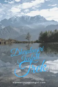
This is a comprehensive guide to completing a Dhaulagiri trek from Larjung. The climax of this Annapurna region side hike is a viewpoint of Dhaulagiri Icefall.
Dhaulagiri mountain is the seventh highest mountain in the world. At 8167m it is the highest peak in the world that stands entirely in one country, that country being Nepal. The name is derived from Sanskrit and means white beautiful mountain. I have to admit it is a fine looking mountain!
Pouring down from the east side of the mountain is the incredible Dhaulagiri Icefall. In this post I describe our Dhaulagiri Icefall trek as a day trip from the Annapurna Circuit trail.

Disclaimer: Some links in this article are affiliate links, which means that if you purchase through them I receive a small commission, at no extra cost to you. This helps cover the cost of running this blog. Thanks for your support!
Dhaulagiri as a side trek from the Annapurna Circuit
In November 2019 we embarked on the biggest hike of our lives. We set out to hike the Annapurna circuit. The climax of the hike is seen by many as the crossing of Thorong La Pass. At 5416m in altitude it is no easy feat. At this height oxygen levels are half what they are at sea level and altitude sickness becomes a real problem.
To combat this issue most trekkers cross the pass from east to west to take advantage of higher altitude teahouses on the east side. Then, once the pass is crossed many trekkers celebrate their victory and finish their trek in Muktinath or Jomsom.
However, there is a little gem of a hike situated near the town of Larjung, some 40km after crossing the pass. That gem is the Dhaulagiri Icefall trek.
Prefer to watch rather than read? Then take a look at this video of our Dhaulagiri trekking adventure!
Our Dhaulagiri Trekking Adventure
We sat eating breakfast with a real feeling of excitement for our days adventure. We were fifteen days into our trek by now and up until this point the trail had been well marked and well documented.
However, todays side trip was mostly an unknown.
Whilst reading our Annapurna Sanctuary and Circuit book I came across a section called Dhaulagiri icefall. It was described as a side trek with magnificent views not to be missed. Coincidentally, just after I read that section, a friend of Nicks, who had hiked the circuit several years before also recommended trekking Dhaulagiri.
The book however, gave very little information on the trek, other than the elevation gain and from which town to start. There was also one other catch. It suggested it was too big a hike to undertake in one day and should attempted as a two day camping trip.
Rugged up in thermals and puffys, we sat in our tea houses freezing restaurant and began our online research to find out more about this ‘magnificent hike not to be missed’.
However, the only information we could find was about a side trek to Dhaulagiri base camp, which was an 8 day trip. The lonely planet Trekking in the Nepal Himalaya book gives a brief description of how to follow the trail but had no mention of distances or times.
It simply stated that it was too big to attempt in one day and suggested camping somewhere en route.
All very vague.

At 7:30am on 18th November we set off towards Dhaulagiri peak. We had no map, since it was unmarked on our physical Annapurna circuit map or on our online maps.me app. We knew we were in for a tough day with an elevation gain of 1200m, but we had already survived a day like this on our ice lake trek (which was at much higher altitude).
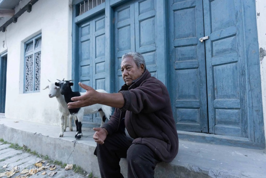
Leaving from the beautiful Thakali village of Larjung, we first had to hike south along the dusty road. Thankfully, at that time in the morning, there weren’t any big trucks or crazy buses motoring by.
After crossing a suspension bridge we shortly came to a signpost for Sekong and Bhutharchho lakes. Here we started on the trail proper. It climbed fairly steeply through a fragrant pine forest until we reached Bhutharchho lake at 2800m. The first of two beautiful lakes on this hike.

After taking some photos we continued along the path and out of the forest. Here we saw two local yak herders sat on a rock. In broken English we asked them the way to the icefall and they motioned that we should cross the wash, then head up the ridge to the (lookers) left. There was a trail here branching off to the right, but that led to a yak kaka they informed us. (A high altitude grazing area)
After crossing the wash we again picked up the blue and white marker flags which indicate a side trail on the Annapurna Circuit. However, the trail led in only one direction – back down the hill towards the second of the two lakes, Sekong lake.
I saw the perfectly still water and clear mountain tops and got completely distracted, making a bee-line for the lakeshore.
After taking our fair share of reflection photos at the lake, we set about trying to find the trail up towards Dhaulagiri peak. After a bit of searching we found a small track which appeared to head in the right direction, though it wasn’t signposted as we thought it would be.

Following this trail through thick bracken we headed into the forest and after crossing the stream started to ascend the ridge. After about 15 minutes of following this trail we started to see the blue and white flags once more. This gave us confidence that we were in fact on the right track!
From this point on it was a pretty relentless ‘up’ until we reached the top.
After a further 15 minutes we came through a slight clearing where Nick spotted some movement in the trees beyond. At first we thought it was a bird but after watching for a while we discovered it was a group of Langur monkeys, jumping from tree to tree.
Continuing through the clearing we once again headed into the forest but this time we were surrounded by bamboo and rhododendron trees. It would be full of colour here in Spring. The switchbacks in this section were particularly steep and slow going but we persevered, still having no real clue where our end point was.
At around 11am we reached 3200m and met two Nepali ladies. They were camping next to a ruined herders hut. They were quite keen to talk with us and we learned that they were there to put up new trail signposts.
Much needed, we thought to ourselves!
We asked if they knew how much further it was to Dhaulagiri icefall but like us, it was their first time hiking Dhaulagiri.
After the obligatory selfies were taken with my didis we marched on. In this clearing we could see the top of the ridge and it still looked a very, very long way up. The forest had now ended and we were surrounded by long tufty grasses and steep exposed edges.
The vultures that we had seen way above in the rhododendron forest were now at eye level. Circling in the thermals, it almost felt like they were waiting for us to collapse. But we continued on up, gaining a little heart every time we saw a blue and white flag.

At around 3500m we came across another ruined herders camp and from this point we could see a signpost at the top of the rise. We zigzagged our way up to the signpost which was marked Dhaulagiri icefall. Our joy on seeing the first signpost marked for the icefall was short lived when we saw it was marked as being 1hr away.
As we looked further up we saw another signpost so again we headed for that. This one had no time indication, just an arrow pointing to another signpost further ahead. Once again we hiked on, our pace gradually slowing as we were now up above 3500m.
As we climbed the mound to reach the final signpost we were excited and relieved to get our first glimpse of the icefall. Equally impressive though, were the views behind us across the Kali Gandaki valley to Annapurna and Nilgiri peaks.

We decided to hike on a little further until we reached some more ruined buildings, at which point we called it a day. We knew it couldn’t be too much further until we could stand above the glacier, but the weather was starting to turn. We grabbed a quick bite before we started to retrace our steps, keen to get down the exposed section and into the forest before we were swallowed by the clouds that were swiftly rolling in.
Our decision to turn around so close to the end, though tough to make, was however quickly justified. By the time we got back to the ladies’ camp, everything above us was completely engulfed in thick fog. Navigating on such an exposed section in that fog would’ve been very hard and potentially dangerous.
Following the trail back down through the forest was a formality and before long we were back at Sekong lake. We sat for a long while admiring the view and watching the clouds rise from the valley, covering the mountains before dispersing into the sky.
We reflected on a successful day in the mountains.
We hadn’t quite reached our goal to look down on the glacier, but we had got a great view of the icefall and more importantly, safely made it back down.
Once we were satisfied that we had enjoyed the scene long enough, we made our final descent down from the lake and back to the roadside. Once back at the tea house we celebrated with beer, momos, homemade apple pie and custard!

To discover what I take on a photography hike like this one, take a look at this post.
The Dhaulagiri Trek Trail Description
Ascent
Note: This trail is not well established in parts, involves some scrambling and has exposed edges. I wouldn’t recommend doing this Dhaulagiri trek if it’s wet.
From Jarjung head south on the road for 3 km. Take the pedestrian suspension bridge on the left to cut the corner. Approximately 200m south of the bridge you will see the signpost for Sekong and Bhutharchho lakes. This trail is marked on maps.me.
The trail ascends fairly steeply through the pine forest along a series of switchbacks until it reaches Bhutharchho lake at 2800m. It continues on until it clears the forest. Bare left to cross the top of the wash. Ignore the track that leads to the right as this heads up an alongside valley and won’t provide access to the icefall.
After crossing the wash you will again see the blue and white marker signs which lead downhill towards the second lake of the hike – Sekong Lake. Walk down to the lake which, if the weather is calm and clear, provides excellent reflection shots of the Annapurna range.
These two holy lakes make up a loop from the road which takes about 2 hours. This trail is well marked and is definitely worth doing by itself. It would be a spectacular spot for sunrise or sunset.
From the lake walk back up the way you came for around 200m. On your left you will see a small track. This track was quite overgrown and looks just like a goat track so is easily missed. The only slight clue is a small rock on the main trail which has a blue and white marker flag. (Though no indication that a turn should be made)

Follow this trail through the forest and soon you will once again see blue and white marker flags on rocks along the way. You exit the pine forest through a clearing then enter a bamboo and rhododendron forest. The trail gets quite steep as it switches back and forth up the hill.
At 3200m you will reach a clearing with a ruined stone building at the far end. As you look up you can clearly see the ridge you need to climb to reach the top. The trail begins this ascent behind the ruined building. The trail climbs through long grasses and there are often multiple trails. It is important in this section to keep your eyes open for the blue and white marker flags.
At around 3500m there is another ruined herders camp which could make for a good camping spot. There is a stream 100m around to the left (beyond the camp) which can be used to fill up water. As you look up the hill you will now see a signpost at the top. Zig zag your way up the hill, following the blue and white marker flags as you go.
Once you reach the signpost, look up and you will see another signpost and another one after that. Once you reach each signpost you will see the next one beyond. At the third sign you will now see the icefall.
At around 3700m the ground levels off and you will once again see some ruined buildings. Ascend the hill in the direction of the icefall to reach the end point, which is a view looking down on the glacier with the icefall beyond.
Descent
For this Dhaulagiri hike descent, simply retrace your steps. At Sekong lake you have the option to go back the way you came past Bhutharchho lake, or walk to the right of Sekong lake and take the trail that bares to the right. This trail leads down through the forest and finishes on the road just a few hundred meters further along the road from where you started.
Walk back along the road to Larjung.
Trail facts and figures
- Start and finish at Larjung: 2400m
- Top herders hut: 3765m
- Elevation gain: 1300m
- Distance: 21km
- Ascent 5 – 6 hours
- Descent 3 – 4 hours
Where to stay
In Larjung we stayed in a great little teahouse called Larjung Lodge. In this village there are at least 3 guesthouses to chose from. We ordered a packed lunch from our lodge to take with us.
This hike could also be accessed by staying at Kokhethanti village, which is 5km down the valley from Larjung. There is only one guesthouse in this small village, called Dhaulagiri Icefall Lodge.
What to take on a Dhaulagiri Icefall trek
- Sturdy walking boots: The trail is not well established in parts and is very slippery if wet.
- Warm layers and waterproofs: You’re heading to an icefall so it’s going to be cold up there!
- Water bottle with a filter: This will allow you to safely refill at the abandoned herders camp. I use a Water To Go bottle which you can buy here.
- Food and drinks: There are no teahouses on this trek.
For a complete Annapurna Circuit packing list, take a look at this post.
Have you hiked the Annapurna Circuit and did you know about this side hike to Dhaulagiri icefall? Let me know your thoughts below.
Don’t Forget Your Travel Insurance!
For the best deals on travel insurance, check out Safety Wing.
Onward from Nepal
If you like hiking in off the beaten path destinations you might be interested in Hiking Rakaposhi base camp or Nanga Parbat Base camp in Pakistan
If you are continuing your travels from Nepal into India, take a look at my India Survival Guide to make sure you stay fit and healthy.
Sign up to my monthly newsletter!
Like it? Pin it for later!